

Corridor Transit and Community Development Strategy
-
Corridor Plan + Transit Feasibility Study, Part 1 | 2014-2015
Client(s): City of Cleveland, Greater Cleveland Regional Transit Authority/GCRTA
-
4ward Planning, Market Analysis
Cleveland Neighborhood Progress, Facilitator + Engagement + Planning Lead
Michael Baker International, Cycling Infrastructure + Traffic Engineering
Parsons Brinckerhoff, Transit Planning -
Made possible with generous financial support from Enterprise Community Partners and The Cleveland Foundation
-
Facilitator, Convener, Engagement Lead, Planning Lead, Report Authorship
-
41°28'02.2"N 81°42'03.5"W
(West 25th Street, Cleveland, Ohio)
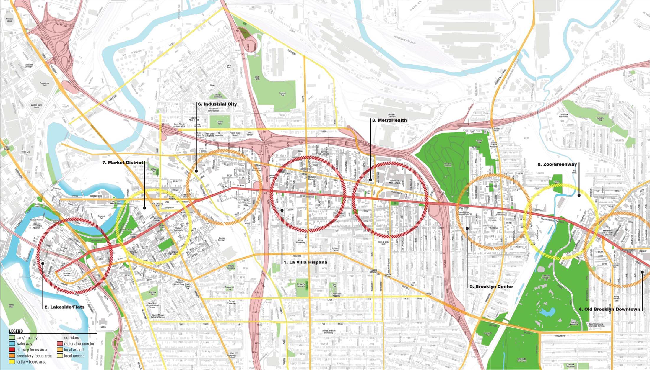
The W25 Transit Development Study brought clarity and consensus to a lingering community development question: What is the ideal transit approach for Cleveland’s West 25th Street corridor and what types of complementary development will be necessary to make it a sustainable reality? Nested within a broader community revitalization effort (the West 25th Street Initiative), this planning process convened a representative group of residents, stakeholders, and CDC staff representatives from four City Neighborhoods (Ohio City, Tremont, Stockyards/Clark-Fulton, and Old Brooklyn), as well as several civic and governmental organizations to find alignment on potential solutions. These individuals directed the consultant team and informed the deliberations of eight working groups, each charged with a different community development perspective (commercial, education, housing, pedestrian, recreation, services, transportation, workforce). The working groups convened with the public on three separate occasions to solicit their feedback and incorporate this input into community direction.
In the end, several factors played into a consensus decision to advocate for what the consultant team coined “BRT - Low Intensity” for the entirety of the corridor section. Most similar to the newly implemented “Cleveland State Line” on Clifton Boulevard, the West 25th Street corridor should feature dedicated lanes for bus and bicycle traffic, consolidated stops with enhanced waiting environments, branded bus routes, and transit signal priority. For their part, CDC staff along the corridor will utilize every tool at their disposal and leverage every development opportunity that arises to foster the kinds of dense, urban development necessary to sustain this infrastructure and gradually create a world-class corridor in the heart of Cleveland’s near West Side.
The report also suggested development strategies to support transit infrastructure, including a minimum density of 8 to 12 housing units per acre, discouragement of suburban building typologies and materials, and the need for the neighborhood(s) to work closely with the City of Cleveland, Greater Cleveland Regional Transit Authority (GCRTA), and the Northeast Ohio Areawide Coordinating Agency (NOACA) to implement development controls and policy frameworks that promote the broader community vision without compromising individual projects.
2015 Final Report HERE
2018 Transit Implementation Plan HERE
Project advanced with Cleveland Neighborhood Progress

W25 Corridor


West 25th Street

Nodal Development Framework

Framework Detail
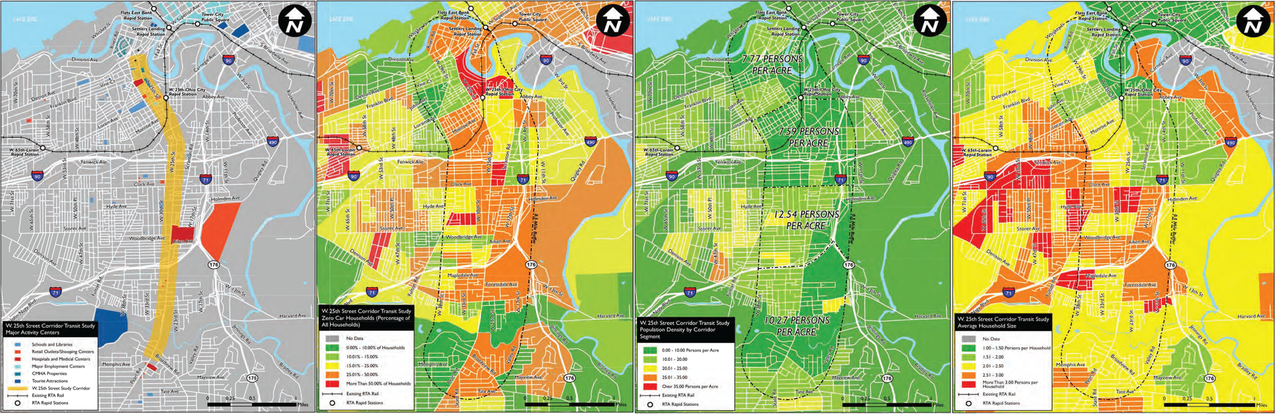
Transit Analysis

Housing Character Inventory

Transit Service Inventory

Transit Assessment Matrix
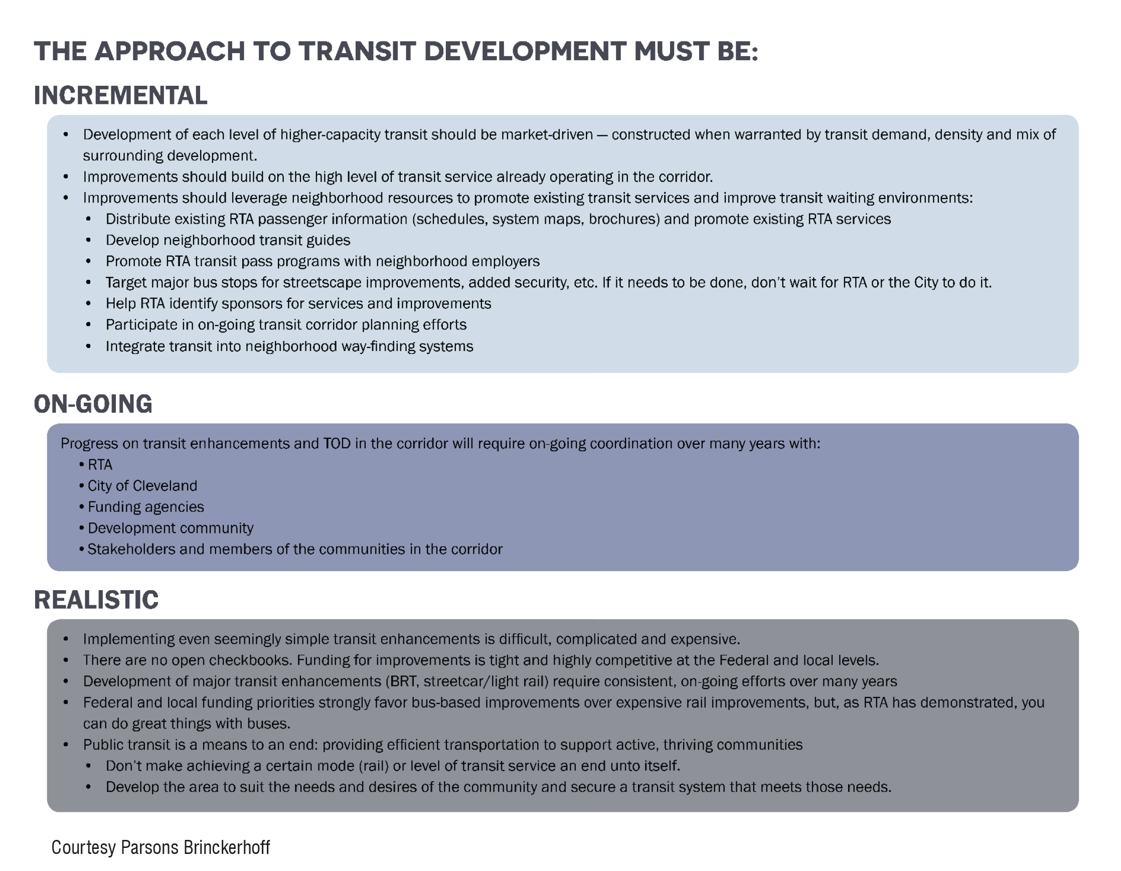
Transit Implementation Considerations