

Accommodating History and Growth through Zoning
-
Lafayette Square/Upper Central Business District Height Study
Planning + Zoning Study | 12 months | 2007-08Client(s): Downtown Development District of New Orleans
-
H3 Studio
-
Process funded by the New Orleans Downtown Development District
-
Project Management, Facilitation, Site Analysis, Planning, Urban Design Assistance, Zoning Education
-
29°56'53.6"N 90°04'13.2"W
(Lafayette Square/Upper CBD, New Orleans, Louisiana)
New Orleans has a rich history of preservation of structures and neighborhoods which have become iconic for the very notion of what it means to preserve history. Consequently, the dilemma of old versus new—or short versus tall—is of paramount importance in the role of maintaining this rich tradition. In the months preceding the study, many real estate developers on the front edge of Hurricane Katrina recovery submitted ambitious proposals for the area addressed in this study, some of which sought dramatic variances to building height and floor area ratio (FAR) allowances. These proposals mobilized local preservationists and community activists concerned that development of the proposed scale would threaten the integrity of two nationally-recognized historic districts, the Lafayette Square Historic District and the Warehouse District. The Downtown Development District commissioned the study to bring resolution to the divisive issue and recruited a diverse task force comprised by representative stakeholders that negotiated consensus:
Vision: To create a vibrant, pedestrian-oriented mixed-use neighborhood worthy of its reputation as a nationally-recognized historic district that meets the living, working, social and recreational needs of its residents, businesses and visitors while presenting continued investment and development opportunities; thereby assuring its long-term sustainability and vitality.
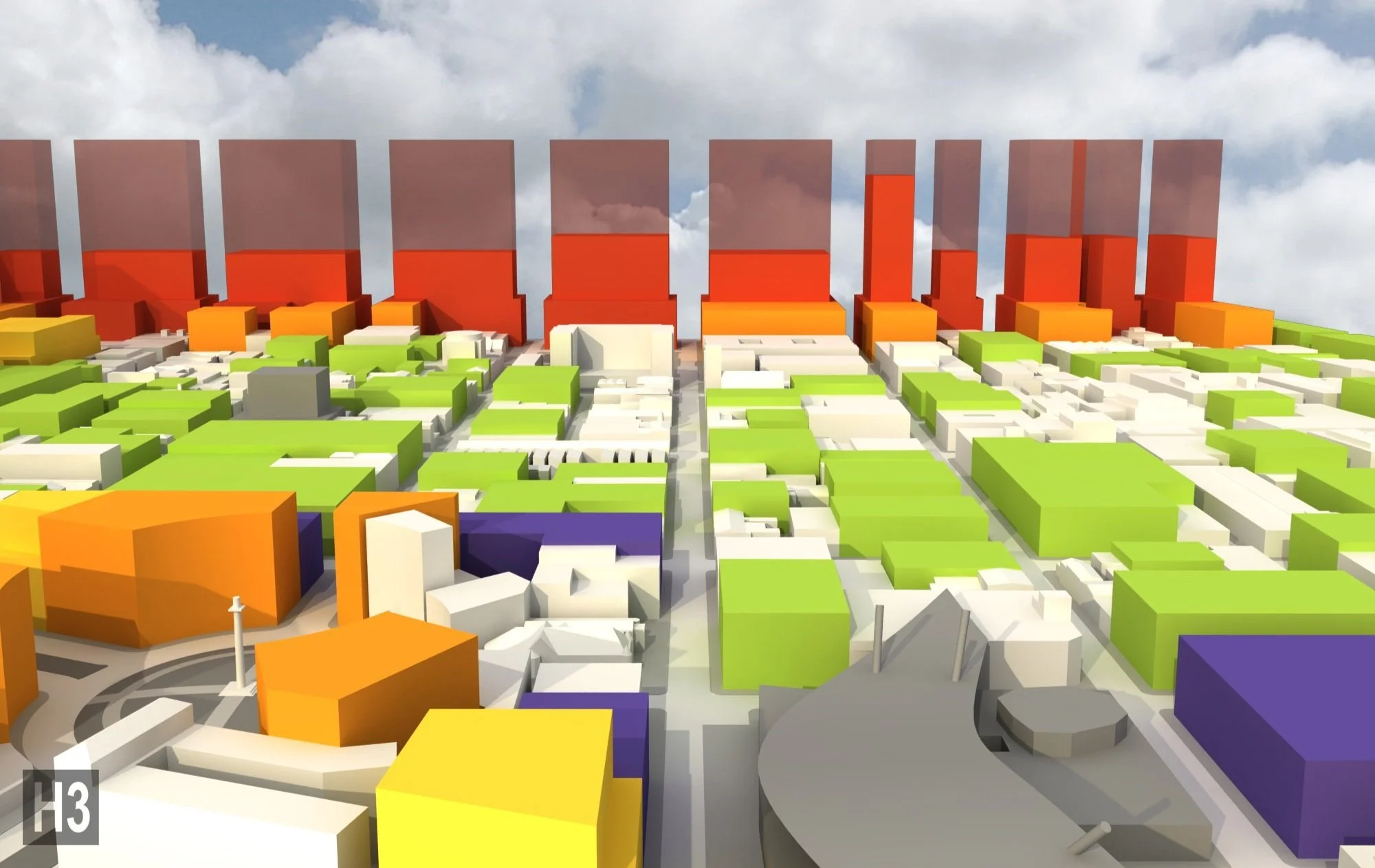
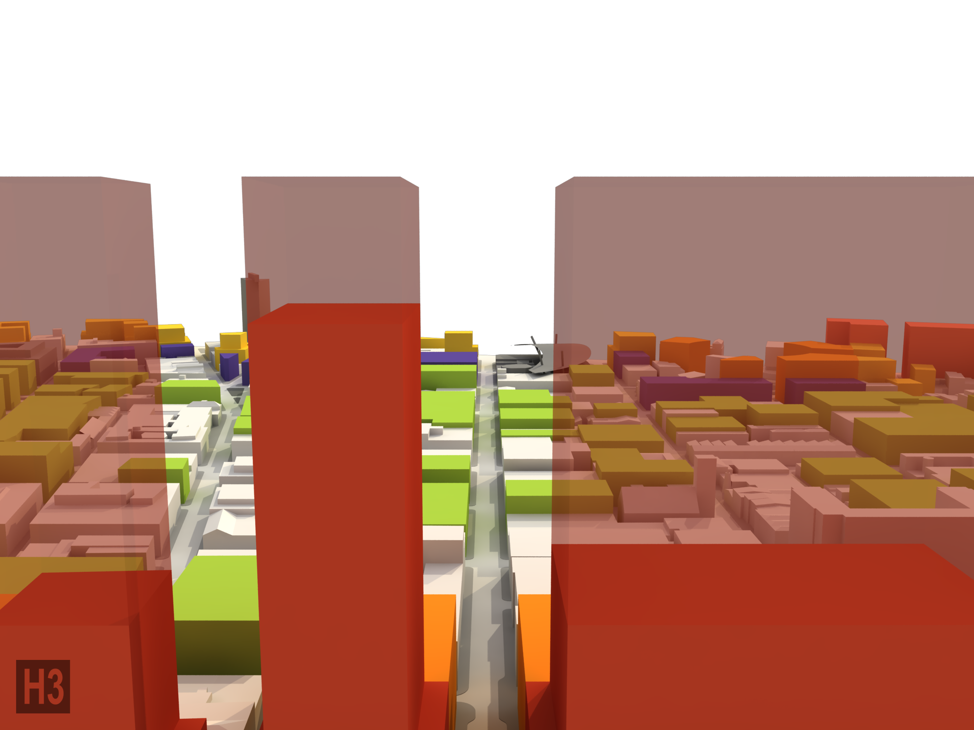
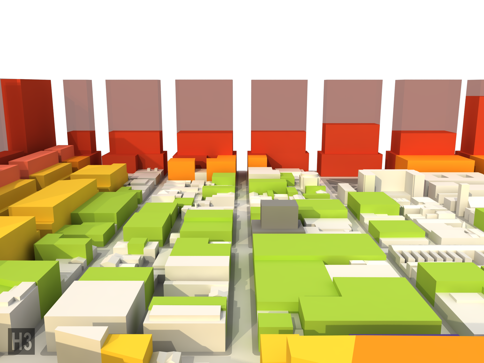
Various zoning approaches, including current statutes, were digitally modeled and analyzed so stakeholders could fully understand the implications of these decisions on the experiential quality of the study area. The process resulted in a series of fixed height zones (red, salmon, orange, yellow, purple) around the periphery of the historic districts with an interior (green) that was contextually-determined with an adjacency formula that provided clear direction for developers and regulators alike on what a given site would be allowed.
The report can be seen HERE
Project completed with H3 Studio

District looking North (downtown)

District looking East (river)

District looking South

District looking West

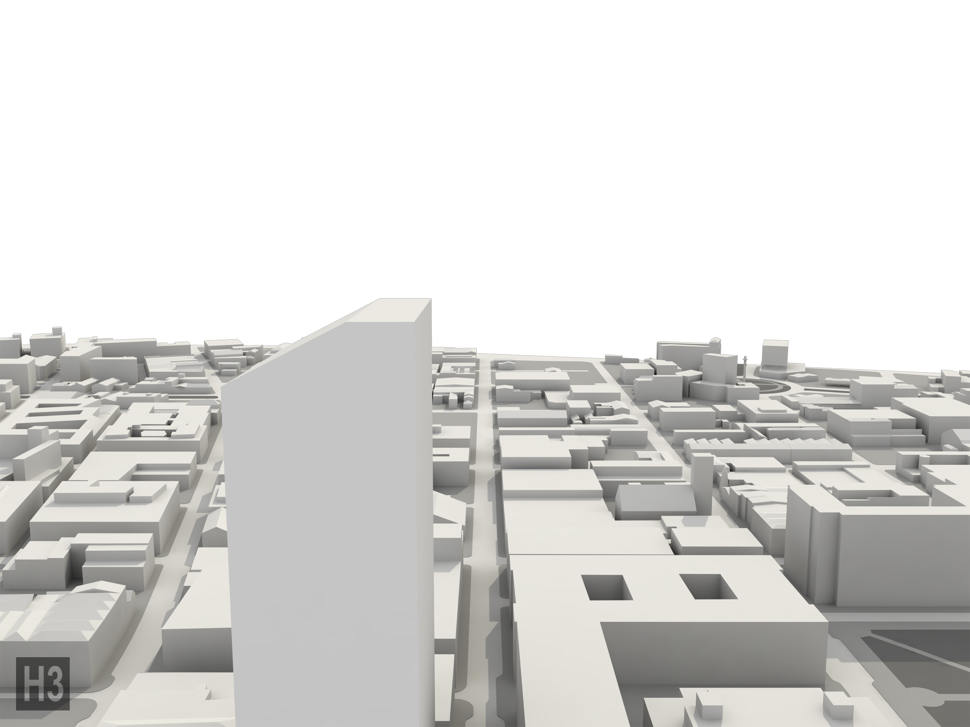
Barrone Street, existing

Barrone Street, proposed zoning

Julia Street, existing

Julia Street, proposed zoning
Magazine Street, existing
Magazine Street, proposed zoning

Camp Street, existing
Camp Street, proposed zoning

Carondolet Street, existing

Carondolet Street, proposed zoning

Barrone Street, existing

Barrone Street, proposed zoning